The Maritime Information Application
MAIA is a maritime information tool to be installed as a supplement to plotters or mobile navigation devices in order to optimize access and readability for critical yacht data.
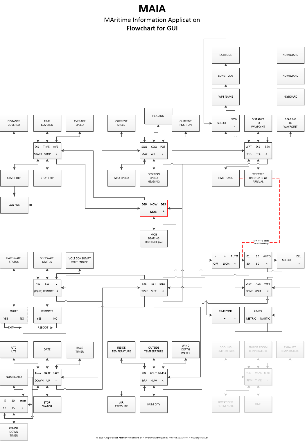
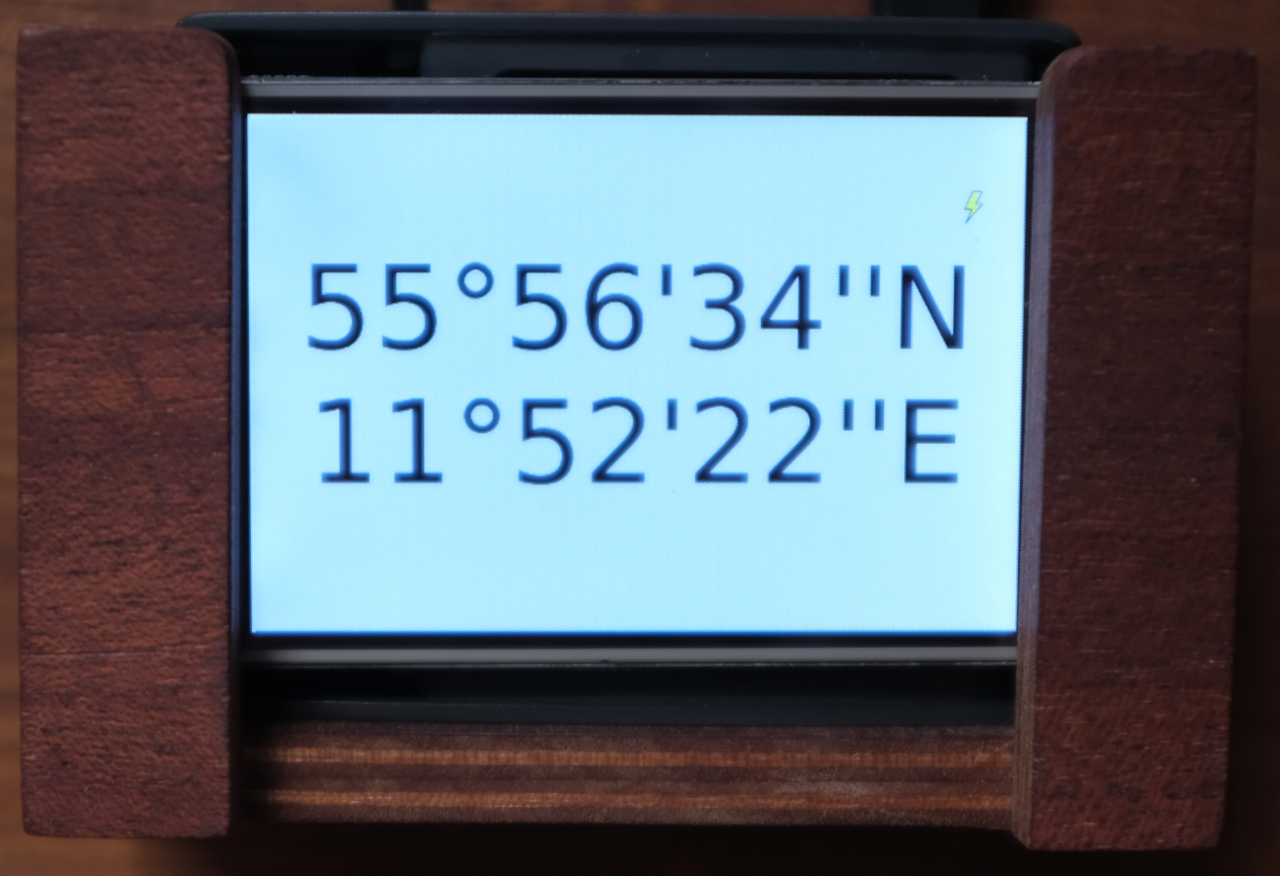
MAIA is made for touch screens and all menus are designed with an intuitive user interface which enables quick and easy access to information during sailing through a simple layout that is visible everywhere in a standard cockpit.
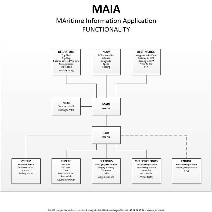
When switching on the system the top line menu presents 3 categories:
Actions and information related to departure
Overview of actual position
Data related to the destination
The Main menu also features a MOB (Man Over Board) function and access to the sub menus
Functionality
Departure include Trip Start and Trip Stop functions. Other functions displays Distance Covered, Trip time, Average Speed and Max Speed. A digital log is automatically enabled when the trip is started. It saves all data at short intervals in a format that can be used in spreadsheets for further analysis.
NOW shows information about actual Position such as GPS-Coordinates, Speed and Heading
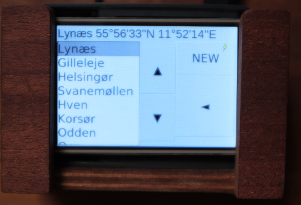
Destination features a Waypoint selector/editor and shows distance/bearing to selected waypoint. There is also a time calculator showing estimated Time-To-Go and ETA.
The sub menu section gives access to the Timer- and Race modules but also a meteorological function presenting data from the temperature, air pressure and humidity sensors. System information, battery status and settings can also be reached from this section.
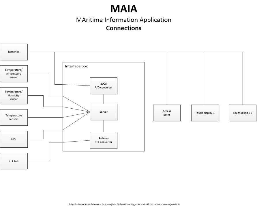
The MAIA application is prepared for connecting sensors in engine room (temperature and RPM) and the system can be expanded also to handle input from a NMEA0183 bus in order to show data from depth and wind sensors etc.
Please take a look at the diagrams below in order to get a full overview of all features in MAIA.

Further information and code can be found here: